- Reference
- Austrobaileya 2:406-407 (1987)
- Conservation Code
- Not threatened
- Naturalised Status
- Native to Western Australia
- Name Status
- Current
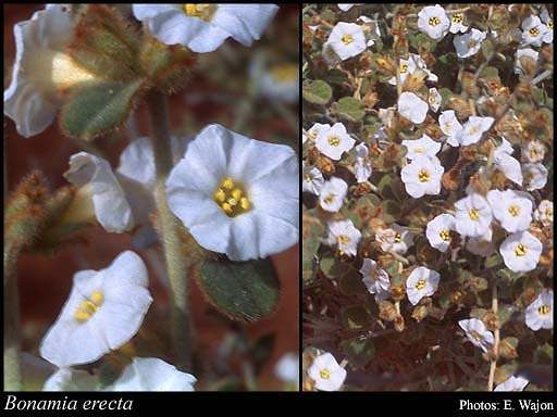
Shrub, to 0.4 m high. Fl. white-cream, Jul. Red sand.
Distribution
- IBRA Regions
- Carnarvon, Central Ranges, Dampierland, Gascoyne, Gibson Desert, Great Sandy Desert, Great Victoria Desert, Little Sandy Desert, Murchison, Pilbara.
- IBRA Subregions
- Ashburton, Augustus, Cape Range, Carnegie, Central, Chichester, Dune Field, Eastern Murchison, Fitzroy Trough, Fortescue, Hamersley, Lateritic Plain, Mackay, Mann-Musgrave Block, McLarty, Pindanland, Roebourne, Rudall, Shield, Trainor, Wooramel.
- IMCRA Regions
- Eighty Mile Beach, Ningaloo, Pilbara (nearshore).
- Local Government Areas (LGAs)
- Ashburton, Broome, Carnarvon, Derby-West Kimberley, East Pilbara, Exmouth, Karratha, Laverton, Leonora, Meekatharra, Menzies, Ngaanyatjarraku, Port Hedland, Sandstone, Upper Gascoyne, Wiluna.