- Reference
- Biblioth.Bot. 22(89):1217 (1929)
- Conservation Code
- Not threatened
- Naturalised Status
- Native to Western Australia
- Name Status
- Current
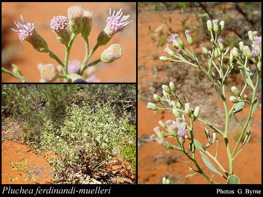
Shrub, to 1.5 m high, plant densely tomentose, leaves 1.5-5.5 cm long. Fl. purple, Sep to Nov. Sand to clay, alluvium, gravel, limestone, ironstone. Stony creeks, sandplains, pindan flats, swampy areas, salt marshes, flood plains.
Distribution
- IBRA Regions
- Carnarvon, Central Kimberley, Dampierland, Gascoyne, Gibson Desert, Great Sandy Desert, Little Sandy Desert, Northern Kimberley, Ord Victoria Plain, Pilbara, Tanami.
- IBRA Subregions
- Ashburton, Augustus, Cape Range, Chichester, Fitzroy Trough, Hamersley, Lateritic Plain, Mackay, McLarty, Mitchell, Pentecost, Pindanland, Roebourne, Rudall, South Kimberley Interzone, Tanami Desert, Trainor, Wooramel.
- IMCRA Regions
- Canning, Pilbara (nearshore).
- Local Government Areas (LGAs)
- Ashburton, Broome, Carnarvon, Derby-West Kimberley, East Pilbara, Exmouth, Halls Creek, Karratha, Port Hedland, Wiluna.