- Reference
- Prodr.Fl.Nov.Holland. 414 (1810)
- Conservation Code
- Not threatened
- Naturalised Status
- Native to Western Australia
- Name Status
- Current
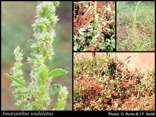
Erect, open annual, herb, to 1 m high. Fl. green/white, Mar or May or Jul. Red sandy loams, gritty red skeletal soil with stony gibbers on the surface, grey-brown loam, pindan soil, laterite. Plains, riverbedas and riverbanks, floodplains, slopes, crests of hills, croplands.
Distribution
- IBRA Regions
- Carnarvon, Central Kimberley, Dampierland, Gascoyne, Great Sandy Desert, Indian Tropical Islands, Little Sandy Desert, Murchison, Northern Kimberley, Ord Victoria Plain, Pilbara, Tanami, Victoria Bonaparte, Yalgoo.
- IBRA Subregions
- Ashburton, Augustus, Berkeley, Cape Range, Chichester, Edel, Fitzroy Trough, Fortescue, Hamersley, Hart, Keep, Mackay, McLarty, Mitchell, Mount Eliza, Pentecost, Pindanland, Purnululu, Roebourne, Rudall, Tanami Desert, Timor Sea Coral Islands, Western Murchison, Wooramel.
- IMCRA Regions
- Canning, Kimberley, Ningaloo, North West Shelf, Pilbara (nearshore), Pilbara (offshore), Shark Bay.
- Local Government Areas (LGAs)
- Ashburton, Broome, Carnarvon, Derby-West Kimberley, East Pilbara, Exmouth, Halls Creek, Karratha, Murchison, Port Hedland, Shark Bay, Upper Gascoyne, Wyndham-East Kimberley.