- Reference
- J.Roy.Soc.Western Australia 22:123 (1936)
- Conservation Code
- Not threatened
- Naturalised Status
- Native to Western Australia
- Name Status
- Current
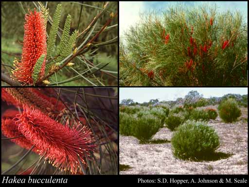
Erect, non-lignotuberous shrub, 1.2-4.5 m high. Fl. red, Aug to Sep. Loamy or clayey sand. Sandplains, flats, roadsides.
Scientific Description
Shrubs, 1.5-4.5 m high; branchlets glabrous or hairy. Leaves alternate, 90-190(-200) mm long, 1-3 mm wide, glabrous; lamina flat, more or less the same width throughout, entire. Inflorescences axillary, red; pedicels 2-3 mm long. Perianth 4-6 mm long, glabrous; ovary glabrous; pistil 17-22 mm long, pollen presenter erect, style glabrous. Follicles 17-25 mm long, 10-15 mm wide, corky tetrahedral projections (on external surfaces of fruit) absent; seed 15-20 mm long (including wing), 7-10 mm wide, the wing discontinuous, marginal, extending down one lateral side only. Flowers in May, June, July, August, September or October. Occurs in the Eremaean (ER) Botanical Province(s), in the Carnarvon (CAR), Yalgoo (YAL), Geraldton Sandplains (GS) or Swan Coastal Plain (SWA) IBRA subregion(s).
Distribution
- IBRA Regions
- Carnarvon, Geraldton Sandplains, Swan Coastal Plain, Yalgoo.
- IBRA Subregions
- Edel, Geraldton Hills, Perth, Wooramel.
- Local Government Areas (LGAs)
- Chapman Valley, Gingin, Greater Geraldton, Northampton, Shark Bay.