- Reference
- Hooker's J.Bot.Kew Gard.Misc. 7:115 (1855)
- Conservation Code
- Not threatened
- Naturalised Status
- Native to Western Australia
- Name Status
- Current
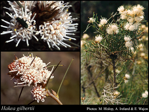
Erect, densely branched, non-lignotuberous shrub, 0.6-2 m high. Fl. white-cream/red-pink, Aug to Sep. White or grey/yellow sand, laterite.
Scientific Description
Shrubs, 0.6-2 m high; branchlets hairy. Leaves alternate, 20-90 mm long, 1 mm wide, glabrous; lamina terete, entire. Inflorescences axillary, white or pink; pedicels 3-4.5 mm long. Perianth 4.5-7 mm long, glabrous; ovary glabrous; pistil 7-9 mm long, pollen presenter conical, style glabrous. Follicles 11-16 mm long, 8-10 mm wide, corky tetrahedral projections (on external surfaces of fruit) absent; seed 9-10.5 mm long (including wing), 4.5-5 mm wide, the wing discontinuous, marginal, extending ± unequally down each lateral side. Flowers in August or September. Occurs in the South-west (SW) Botanical Province(s), in the Geraldton Sandplains (GS), Swan Coastal Plain (SWA), Avon Wheatbelt (AW), Jarrah Forest (JF), Mallee (MAL) or Esperance Plains (ESP) IBRA subregion(s).
Distribution
- IBRA Regions
- Avon Wheatbelt, Esperance Plains, Geraldton Sandplains, Jarrah Forest, Mallee, Swan Coastal Plain.
- IBRA Subregions
- Dandaragan Plateau, Fitzgerald, Katanning, Lesueur Sandplain, Merredin, Northern Jarrah Forest, Perth, Western Mallee.
- Local Government Areas (LGAs)
- Boddington, Bruce Rock, Carnamah, Coorow, Corrigin, Cuballing, Dandaragan, Dumbleyung, Gingin, Goomalling, Kellerberrin, Kent, Kondinin, Kulin, Moora, Narrogin, Pingelly, Quairading, Ravensthorpe, Tammin, Three Springs, Toodyay, Victoria Plains, Wandering, Wickepin, Williams, Wongan-Ballidu, Woodanilling, York.