- Reference
- Gen.Pl. 16 (1843)
- Conservation Code
- Not threatened
- Naturalised Status
- Native to Western Australia
- Name Status
- Current
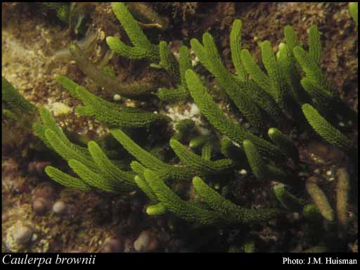
Scientific Description
Habit and structure. Stolon usually robust, (1–)1.5–3 mm in diameter, moderately densely covered with simple ramuli (0.5–)1–2.5 mm long and (150–)300–400(–500) µm in diameter, tapering abruptly to a spinous tip, epilithic or on jetty piles. Erect fronds medium to dark green, with simple or several times irregularly branched axes, usually 3–40 cm high and 3–6(–8) mm across; axes terete, 0.5–1.5 mm in diameter, densely covered throughout with irregularly placed ramuli. Ramuli simple on basal part of axes and 1.5–3(–4) mm long, becoming basally furcate and often bifurcate over most of the axes, 3–4 mm long and (100–)250–350 µm in diameter, terete, upwardly curved, tapering close to their apices to a spinous tip.
Distribution. From Whitfords Beach, Perth, W. Aust., around southern Australia to Walkerville, Vic, and around Tas. New Zealand, Chatham I., Snares I., Lord Howe I.
Habitat. Common on rocks at and just below low tide level, often forming a monospecific community, and recorded to 42 m deep.
[After Womersley, Mar. Benthic Fl. Southern Australia I: 264 (1984)]
Distribution
- IBRA Regions
- Esperance Plains, Geraldton Sandplains, Jarrah Forest, Warren.
- IBRA Subregions
- Geraldton Hills, Recherche, Southern Jarrah Forest, Warren.
- IMCRA Regions
- Leeuwin-Naturaliste, Pilbara (offshore), WA South Coast.
- Local Government Areas (LGAs)
- Albany, Ashburton, Augusta Margaret River, Busselton, Esperance, Greater Geraldton, Irwin, Jerramungup, Manjimup, Rockingham.